QUESTIONS? CALL OR TEXT! 1 (877) 921-6277 or (403) 266-2241
WE SHIP EVERYWHERE!

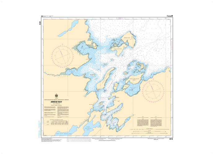
Navigate the sheltered and ecologically rich waters of the eastern Great Northern Peninsula with the specialized detail of CHS Nautical Chart 4518. Providing high-resolution, large-scale coverage of Ariège Bay, this chart is an essential hydrographic tool for mariners entering this protected inlet from the broader Hare Bay system. Known for its calm waters and significant role in the regional fishing and forestry sectors, Ariège Bay offers a critical refuge and navigational corridor near the community of Main Brook.
Chart 4518 features precise mapping of the bay’s inner reaches and the strategic entrance between Decca Point and the surrounding limestone barrens. It provides critical soundings for the approach to the Main Brook wharves, where deep-water access is vital for local industry and supply. Whether you are a commercial fisher, a recreational sailor exploring the scenic "French Shore," or a maritime researcher, this official Canadian Hydrographic Service chart delivers the bathymetry and shoreline topography necessary for safe pilotage through these tide-influenced sub-arctic waters.
Key Features include:
Large-Scale Bay Detail: Comprehensive mapping of the entire Ariège Bay basin, including the waterfront of Main Brook.
Hydrographic Accuracy: Features high-density depth soundings and seabed composition essential for avoiding the narrow rocky ledges and shoals.
Navigation-Critical Infrastructure: Clearly identifies the Main Brook public wharf, regional beacons, and the range lights required for safe entry.
Safety & Hazard Identification: Highlights the "Burnt Point" shoals, submerged rocks, and the coastal currents common to the Hare Bay transition.
Professional Grade: Produced to the rigorous standards of the Canadian Hydrographic Service (CHS) for professional navigation, regional logistics, and GIS spatial analysis.