QUESTIONS? CALL OR TEXT! 1 (877) 921-6277 or (403) 266-2241
WE SHIP EVERYWHERE!

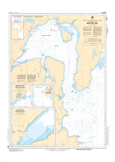
Navigate the strategically vital, deep-water corridors of the Burin Peninsula with the official Canadian Hydrographic Service (CHS) Nautical Chart 4587. This professional-grade marine navigation chart delivers authoritative, high-resolution hydrographic data for Mortier Bay and its immediate approaches within Placentia Bay, Newfoundland. Known as a crucial year-round ice-free port and a major hub for industrial shipping, shipbuilding, and offshore support vessels, Mortier Bay demands precise cartography for safe pilotage.
Spanning a standard large-format 47 x 34 inches, Chart 4587 provides meticulous, high-density depth soundings, detailed shoreline contours, and clear markings for underwater hazards such as treacherous shoals, ledges, and submerged rocks. The chart outlines all critical aids to navigation, including harbor lighthouses, buoys, coastal topography, and designated safe anchoring zones. Bilingual in English and French, this official CHS chart is printed on demand using premium, high-contrast paper, ensuring maximum legibility on your vessel's navigation table under all marine weather conditions.