QUESTIONS? CALL OR TEXT! 1 (877) 921-6277 or (403) 266-2241
WE SHIP EVERYWHERE!

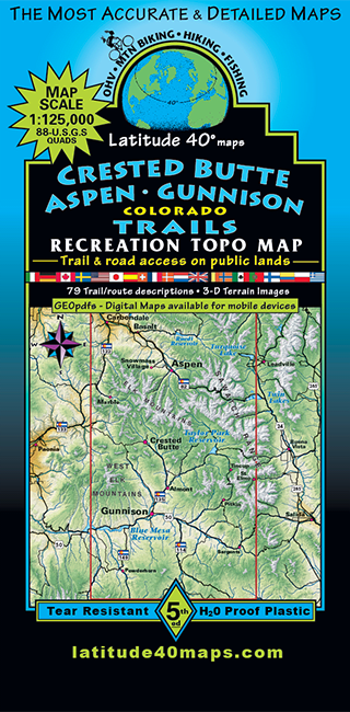
Navigate Colorado's most spectacular mountain passes, wilderness basins, and alpine singletrack with the Crested Butte – Aspen – Gunnison Trails Map by Latitude 40. Providing massive regional coverage, this topographic masterpiece combines all or part of 64 USGS 1:24,000 (7.5-minute) quad maps into a single, high-detail field resource spanning the heart of the Elk Mountains and Gunnison Valley.
Coverage stretches from 13 miles north of Ruedi Reservoir down to Cochetopa Hill in the south, and extends east to Mt. Elmo and west to McClure Pass on Highway 133. Designed using advanced computer-generated 3D elevation-tinting and raster terrain imaging, this map clearly illustrates spatial relationships, deep canyons, and prominent peaks across Western Colorado.
Computer-Generated 3D Terrain: High-definition raster relief imagery and color-tinted elevation shading provide instant visual understanding of steep slopes, alpine ridges, and valley floors.
79 Detailed Route Descriptions: Packed with 79 comprehensive trail write-ups tailored for hiking, mountain biking, horseback riding, and 4WD off-roading.
Multi-Use Network Mapping: Color-coded paths clearly differentiate non-motorized wilderness trails, technical singletrack, dirt roads, and rugged 4x4 tracks.
Extensive Geographic Scope: Unifies major recreation corridors including Aspen, Crested Butte, Gunnison, Taylor Park, Maroon Bells-Snowmass Wilderness, and McClure Pass.
Whether embarking on a high-altitude bikepacking adventure, off-roading historic mining roads, or planning multi-day backcountry hikes between Aspen and Crested Butte, this Latitude 40 trail map delivers authoritative cartographic coverage.