Canadian Dollar
US Dollar
Skip to content
To take full advantage of this site, please enable your browser's JavaScript feature.
Learn how
MAPTOWN
Shop Our Categories
Search the store:
Submit
Search
View cart
PRODUCTS
Deal of the Day
Wall Maps
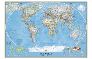
World Maps
Push Pin Travel Cork Maps
Country Maps
Africa
Asia
Australia and New Zealand
Central America and Caribbean
Europe
Middle East
North America
Canada
Mexico
United States
South America
Southeast Asia
Posters
Maps
Aeronautical
Canada Enroute Charts
Canada Flight Suppliments and CAP Instrument Procedures
Canada VFR Navigation Charts (VNC)
Canada VFR Terminal Area Charts (VTA)
Canada Maps
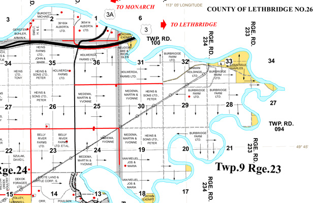
Alberta County and Municipal District Maps
Alberta Hydrographic Lake Charts
Alberta Provincial Resource Access Maps
Alberta Provincial Topographic Maps
Outdoor Recreation Maps
Alberta Recreational Canoe Association
Chrismar
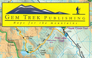
Gem Trek
Go Trekkers
Mussio Ventures
Provincial and Regional Wall Maps
Canadian Topographic Maps
Alberta Topographic Maps
Atlantic Provinces Topographic Maps
British Columbia Topographic Maps
Manitoba Topographic Maps
Newfoundland and Labrador Topographic Maps
Northwest Territories Topographic Maps
Nunavut Topographic Maps
Ontario Topographic Maps
Quebec Topographic Maps
Saskatchewan Topographic Maps
Yukon Topographic Maps
Nautical / Sailing Charts
Canada
Canadian Hydrographic Service Charts - Central Canada
Canadian Hydrographic Service Charts - Eastern and Atlantic Canada
Canadian Hydrographic Service Charts - Northern Canada
Canadian Hydrographic Service Charts - Pacific Coast and Interior British Columbia
Caribbean
Mediterranean
USA
NOAA Alaska Nautical Charts
NOAA East Coast Nautical Charts
NOAA Great Lakes Nautical Charts
NOAA Gulf Coast Nautical Charts
NOAA Pacific Nautical Charts
Rare Antique Maps
Travel and Road Maps
Africa
Asia
Australia and New Zealand
Caribbean
Central America
Europe
Middle East
North America
Canada
Mexico
United States
South America
Southeast Asia
USA Topographic Maps
Alabama Topographic Maps
Arizona Topographic Maps
Arkansas Topographic Maps
California Topographic Maps
Colorado Topographic Maps
Florida Topographic Maps
Hawaii Topographic Maps
Idaho Topographic Maps
Louisiana Topographic Maps
Maine Topographic Maps
Michigan Topographic Maps
Minnesota Topographic Maps
Mississippi Topographic Maps
Missouri Topographic Maps
Montana Topographic Maps
Nebraska Topographic Maps
Nevada Topographic Maps
New Hampshire Topographic Maps
New Mexico Topographic Maps
New York Topographic Maps
North Carolina Topographic Maps
North Dakota Topographic Maps
Oklahoma Topographic Maps
Oregon Topographic Maps
Pennsylvania Topographic Maps
South Carolina Topographic Maps
South Dakota Topographic Maps
Tennessee Topographic Maps
Texas Topographic Maps
Utah Topographic Maps
Virginia Topographic Maps
Washington Topographic Maps
West Virginia Topographic Maps
Wisconsin Topographic Maps
Wyoming Topographic Maps
Maps for Kids
Oil and Gas
Atlases
Divestco
Road Maps
Techskill
Digital Maps
Etopo Digital Maps - Canadian Topographic Map Packages
Garmin MapSource GPS Software
Travel Guides & Books
Aviation
Colouring Books
Nautical and Sailing Guides & Publications
Phrase and Language Guides
Recreation
Canoe, Kayak and Watersports
Climbing and Scrambling
Cycling
Safety and Reference
Walking and Hiking
Winter Recreation
Reference Atlases
Reference, Historical and Non-fiction
Travel Guides
Africa
Asia
Australia
Caribbean
Central America
Europe
Middle East
North America
Canada
Mexico
United States
South America
South Pacific
Southeast Asia
Oil and Gas
Brands
Backroad Mapbooks
Butler Motorcycle Maps
Delorme Road Atlases
Freytag & Berndt
Gem Trek
GM Johnson
ITMB
Lonely Planet Guide Books
Marco Polo
Michelin
National Geographic
Travel and Road Maps
Adventure Maps
Benchmark State Maps & Atlases
Destination City Maps
Destination Maps
State Guide Maps
Trails Illustrated Maps
Wall Maps
Rand McNally
Replogle Globes
Rite in the Rain
Reise
Map Town
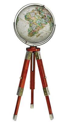
Globes
Desktop Globes
Floor Model Globes
Solar Powered (MOVA) Globes
Illuminated (Light Up) Globes
Inflatable Globes
Globes for Kids
Bar Globes
Accessories
Compasses and Magnifiers
Games, Puzzles and Playing Cards
Map Tubes, Wire Bins and Storage Options
Notebooks, Notepads, Pens & Pencils
Novelty Items
Reference Cards
Push Pins, Flag Pins, Stickers and Markers
Travel Accessories and Adapter Plugs
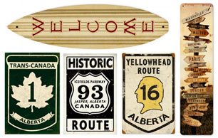
Vintage Metal Novelty Signs
Waterproof Packs, Waterproofing and Nautical Supplies
Custom Maps & Services
Custom Framing
Custom Laminating
Custom Mapping
Custom Mapping
WIKI
About Us
About Us
Returns
Shipping
Site Help / FAQ
SERVICES
Nav Menu 4
Nav Menu 5
Nav Menu 6
Nav Menu 7
SEARCH BY
Brand
A-Z Maps
Bradt
Cartographia
CCC Maps
Chrismar
Delorme
Fodors
Footprint
Franko Maps
Freytag & Berndt
Gem Trek
Go Trekkers Inc
Go Trekkers
Go Trekkers
Guia Roji
Hema Maps
IGN
IGN
ITMB
JonGlez
Kunth
Lonely Planet
Map Art
MapStudio
Michelin
Moon
Mussio Ventures
National Geographic
Ordnance Survey
Rand McNally
Rick Steves
Rother
VanDam
Wizard Publications
Zagier and Urruty
GM Johnson
Reise
Map Town
Country
Afghanistan
Albania
Algeria
American Samoa
Andorra
Angola
Anguilla
Antarctica
Antigua
Argentina
Armenia
Aruba
Australia
Austria
Azerbaijan
Bahamas
Bahrain
Bangladesh
Barbados
Barbuda
Belarus
Belgium
Belize
Benin
Bermuda
Bhutan
Bolivia
Bosnia and Herzegovina
Botswana
Brazil
British Virgin Islands
Brunei Darussalam
Bulgaria
Burkina Faso
Burundi
Cambodia
Cameroon
Canada
Cape Verde
Cayman Islands
Central African Republic
Chad
Chile
China
Christmas Island
Colombia
Comoros
Congo
Congo - Democratic Republic
Cook Islands
Costa Rica
Croatia
Cuba
Cyprus
Czech Republic
Denmark
Djibouti
Dominica
Dominican Republic
Ecuador
Egypt
El Salvador
Equatorial Guinea
Equatorial Guinea
Eritrea
Estonia
Ethiopia
Falkland Islands
Faroe Islands
Fiji
Finland
France
French Guiana
French Guiana
French Polynesia
Gabon
Gambia
Georgia
Germany
Ghana
Greece
Greenland
Grenada
Guadeloupe
Guam
Guatemala
Guinea
Guinea-Bissau
Guyana
Haiti
Holy See - Vatican
Honduras
Hong Kong
Hungary
Iceland
India
Indonesia
Iran
Iraq
Ireland
Province / State
Alabama
Alaska
Alberta
Arizona
Arkansas
British Columbia
California
Colorado
Connecticut
Delaware
Florida
Georgia
Hawaii
Idaho
Illinois
Indiana
Iowa
Kansas
Kentucky
Louisiana
Maine
Manitoba
Maryland
Massachusetts
Michigan
Minnesota
Mississippi
Missouri
Montana
Nebraska
Nevada
New Brunswick
New Hampshire
New Jersey
New Mexico
New Mexico
New York
Newfoundland and Labrador
North Carolina
North Dakota
Northwest Territories
Nova Scotia
Nunavut
Ohio
Oklahoma
Ontario
Oregon
Pennsylvania
Prince Edward Island
Quebec
Rhode Island
Saskatchewan
South Carolina
South Dakota
Tennessee
Texas
Utah
Vermont
Virginia
Washington
Washington, DC
West Virginia
Wisconsin
Wyoming
Yukon
CANADIAN TOPOGRAPHIC MAPS-SHOP CANADIAN TOPOS
Rite in the Rain »
Puzzles & Playing Cards »
Vintage Metal Signs »
Land Ownership Maps »
County & Municipal District Maps
Travel Maps »
Gem Trek Hiking Maps »
Floor & Desktop Globes »
World Wall Maps »
Lonely Planet Guides & Maps »
Nautical Charts »
Canadian Hydrographic Charts
The Shuswap & Adams Lake Regional Wall Map
Our Price:
$29.95
The World's Largest Cities - Map Blocks
Our Price:
$16.95
Spilhaus Projection World Wall Map
Our Price:
$24.95
MOVA Globe of the MOON - 4.5 Inch
Our Price:
$298.00
Basecamp Cards - The Outdoor Game
Our Price:
$18.95
Calgary Downtown & Beltline Wall Map
Our Price:
$29.95
Calgary Detailed Wall Map
Our Price:
$39.95
ABANDONED ALBERTA PICTURE BOOK
Our Price:
$34.95
Alberta Geological Strikes & Wells map
Our Price:
$225.00