QUESTIONS? CALL OR TEXT! 1 (877) 921-6277 or (403) 266-2241
WE SHIP EVERYWHERE!


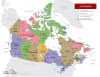
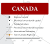
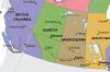
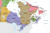
Introduce young explorers to the geography of the Great White North with this Simplistic and Colorful Canada Wall Map. Specifically designed as an educational resource for the classroom and home, this 26" x 20" poster provides a clear, high-contrast view of Canada’s 10 provinces and 3 territories. By stripping away complex topographical data, this map focuses on the essentials: vibrant color-coding that makes political boundaries pop, bold text for province and territory names, and clearly marked national and provincial capital cities.
Perfect for students from Kindergarten through Grade 6, this map helps children develop a sense of place—understanding where they live in relation to the rest of the country. To ensure it survives the rigors of a busy classroom or a child's bedroom, the map comes professionally laminated. This high-quality finish provides a "washable" surface that protects against light damage, fingerprints, and wear, while allowing the use of wet-erase markers for interactive lessons. Whether you’re teaching the "Provinces and Capitals" song or just want a bright, engaging piece of Canadian decor, this map is the ideal balance of simplicity and durability.