QUESTIONS? CALL OR TEXT! 1 (877) 921-6277 or (403) 266-2241
WE SHIP EVERYWHERE!

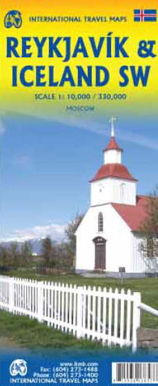
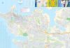
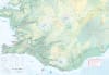
Experience the rugged beauty, geothermal wonders, and vibrant urban culture of the North Atlantic with the authoritative Reykjavik & SW Iceland Travel Reference Map. Masterfully designed for self-drive road-trippers, campervan explorers, and independent weekend hikers, this premium double-sided map offers unparalleled geographic detail of Iceland’s most popular transit and adventure corridor. Blending a highly detailed regional scale for Southwest Iceland with a high-density urban street index for the capital, this cartographic guide ensures you navigate the land of fire and ice with absolute confidence.
The double-sided layout perfectly isolates the bustling urban capital region from the sprawling, wilderness-dominated volcanic landscapes, maximizing text legibility and eliminating map clutter.
Side One (Reykjavik City Street Plan): Features an ultra-detailed, highly readable street-level index of Iceland's vibrant capital city at a crisp 1:8,500 scale. This comprehensive layout makes it effortless to navigate downtown streets, locate parking zones, find boutique hotels, and walk to iconic landmarks like the Hallgrímskirkja church, the Harpa Concert Hall, and the Old Harbour.
Side Two (Southwest Iceland Regional Map): Zooms out to a comprehensive 1:125,000 driving scale, mapping the entire southwestern peninsula (Reykjanes) and extending deeply into the legendary Golden Circle route. It showcases full topography, primary highways, and secondary gravel roads to ensure safe navigation through shifting volcanic valleys.
Far more than a simple city atlas, this travel reference map is heavily overlaid with intuitive symbols pointing you directly to Iceland’s premier natural and historic wonders. It features clear, high-accuracy mapping for:
Geothermal & Wellness Sites: Smooth navigation to the world-famous Blue Lagoon, local hot springs, and hidden geothermal pools.
The Golden Circle Circuit: Explicitly plots the routes and staging zones for Þingvellir (Thingvellir) National Park, the explosive Geysir geothermal area, and the roaring Gullfoss waterfall.
Coastal & Wilderness Features: Clearly identifies black sand beaches, dramatic lighthouses, remote hiking trailheads, waterfalls, campsites, petrol stations, and whale-watching ports.
Printed on high-quality, high-contrast presentation paper, this large-format map folds down into a compact, pocket-friendly travel size that fits effortlessly into your daypack, jacket pocket, or rental car glovebox. Complete with a comprehensive place-name index and an easy-to-read multilingual legend, it stands as your indispensable, signal-free safety companion through the breathtaking landscapes of Southwest Iceland.