QUESTIONS? CALL OR TEXT! 1 (877) 921-6277 or (403) 266-2241
WE SHIP EVERYWHERE!

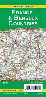
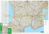
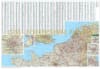
Navigate Western Europe with confidence using the France & Benelux Road Map by GM Johnson. This expertly designed, two-sided folded map is the ultimate companion for road-tripping through France, Belgium, the Netherlands, and Luxembourg.
Engineered for clarity and ease of use, this map features a scale of 2 inches to 60 km, providing a perfect balance between regional overview and local detail. It highlights a comprehensive network of motorways, secondary roads, and rural routes, complete with point-to-point distances to help you estimate travel times accurately. Beyond the asphalt, the map is rich with tourist information, marking significant points of interest, national parks, and cultural landmarks. With a full place-name index and a clear, multi-language legend, this map ensures you can easily locate even the smallest villages across the Benelux region and the French countryside.
Key Features:
Two-Sided Detailed Coverage: Maximize your view of Western Europe with a front-and-back layout that covers the entire territory without sacrificing legibility.
Precise Scale: Rendered at 2" = 60 km, ideal for long-distance navigation and cross-border route planning.
Comprehensive Travel Data: Includes a full index for quick city/town searches and a detailed legend for identifying road types and amenities.
Tourism Ready: Highlights major points of interest (POIs) and scenic routes, making it perfect for leisure travelers and van-lifers.
Durable & Portable: A high-quality folded design that fits easily in a glove box or backpack, built to withstand frequent folding and unfolding.