QUESTIONS? CALL OR TEXT! 1 (877) 921-6277 or (403) 266-2241
WE SHIP EVERYWHERE!



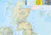
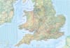
The Great Britain Travel & Road Map is the ultimate reference for exploring all of Great Britain. Printed at a detailed 1:720,000 scale, this map displays highways, primary and secondary roads, railways, and ferry paths with travel times to help plan routes efficiently.
Tourist icons indicate points of interest, including cultural landmarks, historic sites, and natural attractions. Rivers, lakes, and waterfalls are clearly marked, while the map’s color-coded elevation shading highlights the UK’s varied terrain, making it easy to visualize hills and valleys.
Inset maps provide additional detail for the Shetland Islands and Orkney Islands, ensuring coverage of the entire country. This map is perfect for travelers, tourists, road trippers, and anyone navigating Great Britain.
Scale: 1:720,000
Displays highways, major roads, railways, and ferry routes
Travel times included for key routes
Tourist icons for points of interest and attractions
Rivers, lakes, waterfalls, and other geographic features clearly marked
Elevation color-coded for terrain visualization
Insets for Shetland Islands and Orkney Islands
Ideal for travel planning, sightseeing, and road trips
Tourists exploring Great Britain
Road trips and travel planning
Navigating UK highways, roads, and railways
Outdoor enthusiasts seeking natural features and landmarks