QUESTIONS? CALL OR TEXT! 1 (877) 921-6277 or (403) 266-2241
WE SHIP EVERYWHERE!

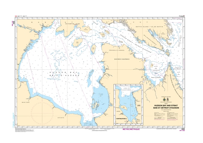
Navigate the expansive, remote, and ice-frequented waters of Canada’s historic subarctic corridor with the official Canadian Hydrographic Service (CHS) Chart 5002, covering the Hudson Strait and Hudson Bay. This comprehensive, large-scale marine chart is an indispensable tactical resource for Arctic commercial shipping vessels, northern supply fleets, deep-sea mariners, and scientific research expeditions charting courses through Nunavut, northern Quebec, and the gateway to Manitoba’s Port of Churchill.
Engineered to provide crucial overview mapping of these vast and challenging northern waters, this chart delivers essential hydrographic data. It features critical oceanic depth soundings, continental shelf bathymetry, major island archipelagos, coastal approach pathways, and foundational navigation markers necessary for long-range plotting in the Canadian North. Whether you rely on this print-on-demand chart as a vital physical backup to your ship's electronic navigation systems or wish to display it as a majestic, beautifully detailed piece of Arctic geography in your home, corporate office, or yacht club, it offers unmatched perspective. Printed on premium, heavy-duty media, it is built to handle rigorous onboard environments or serve as an elegant conversation piece celebrating Canada's rich maritime history.