QUESTIONS? CALL OR TEXT! 1 (877) 921-6277 or (403) 266-2241
WE SHIP EVERYWHERE!

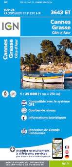

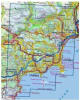
Experience the perfect blend of Mediterranean glamour and rugged Provençal hills with the IGN TOP 25 Cannes / Grasse / Côte d’Azur Map (3643 ET). This ultra-detailed 1:25,000 scale topographic map is the definitive guide for hikers, cyclists, and travelers looking to go beyond the red carpet. At this precision—where 1cm on paper represents 250m on the ground—every coastal "sentier," perfume-country track, and villa-lined street is mapped with total accuracy.
This map is your essential companion for exploring the Perfume Capital of Grasse and the luxurious shores of Cannes and Antibes. It features comprehensive coverage of the Boulevard de la Croisette, the historic Le Suquet district, and the panoramic trails of the Estérel and Tanneron massifs. For outdoor enthusiasts, it highlights the GR® and GR de Pays® networks, including coastal paths with turquoise sea views and hill trails overlooking olive groves. With 5 to 10-metre contour intervals, shaded relief for the Prealps foothills, and full GPS compatibility (UTM grid), this trilingual map ensures you can navigate from the sandy beaches of the Riviera to the scenic balconies of the hinterland with confidence.
Scale: 1:25,000 (1cm = 250m)
Series: TOP 25 (Orange cover - High Tourist Interest)
Key Locations: Cannes, Grasse, Antibes, Mougins, Valbonne, Vallauris, and the Îles de Lérins.
Trail Detail: Overprint of GR® long-distance footpaths, cycle routes, and local leisure symbols (campsites, viewpoints, and historic sites).
Navigation: Fully GPS compatible with UTM grid and 5' latitude/longitude intervals.