QUESTIONS? CALL OR TEXT! 1 (877) 921-6277 or (403) 266-2241
WE SHIP EVERYWHERE!


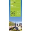
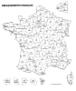
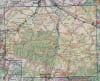
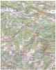
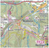
Explore the "Land of the Cathars" with the IGN Top 100 Ariège Map. This brand-new revision, part of the Top 100 Tourisme series (Map D09), offers a definitive 1:100,000 scale view of Department 09. Located in the heart of the French Pyrenees, Ariège is a paradise for adventurers, and this map is specifically engineered to bridge the gap between a standard road map and a high-detail topographic guide.
Whether you are driving the winding mountain passes to Foix, cycling the foothills of the Pyrénées Ariégeoises Regional Natural Park, or planning a trek on the legendary Sentier des Cathares, this map provides the precision you need. It highlights the complete GR® hiking network, including the high-altitude GR 10, alongside safe cycling routes and greenways. The revised cartography ensures that cultural landmarks like prehistoric caves (Niaux), medieval castles (Montségur), and churches are clearly indicated. With contour lines for elevation relief and full GPS compatibility, this trilingual map (French/English/German) is the essential tool for discovering one of France's most rugged and historic regions.