Vaucluse IGN Top 100 Map | Avignon, Mont Ventoux & Luberon Road Map
$
Product Code: IGN84
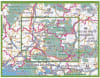
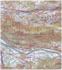
Explore the sun-drenched heart of Provence with the IGN Top 100 Vaucluse Map. Part of the specialized Top 100 Tourisme series (Map D84), this 1:100,000 scale map is the definitive guide for Department 84. Revised in 2024–2025, it is engineered for travelers who want to experience the region’s diverse landscapes—from the historic ramparts of Avignon and Carpentras to the soaring heights of Mont Ventoux and the perched villages of the Luberon Regional Natural Park.
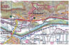
This map is a powerhouse for active tourism. Developed in partnership with the AF3V, it highlights an extensive network of VéloRoutes and Voies Vertes, including the famous "Luberon à Vélo" circuits.For hikers, the map provides a clear overprint of all GR® and GR de Pays® networks, including trails leading through the Gorges de la Nesque and the lavender fields of the Sault plateau.The cartography offers exceptional topographic detail with contour lines and shaded relief, pinpointing cultural landmarks like the Palais des Papes, Roman ruins in Vaison-la-Romaine, and hidden caves and panoramic viewpoints.Fully GPS compatible (5km UTM grid) and featuring a trilingual legend, this map is the essential tool for discovering Vaucluse by car, bike, or on foot.
Quick Reference: Map Number Guide
New Series Code:D84 (Vaucluse)
Classic Series Equivalent:Map 162 (Avignon / Nîmes) and Map 163 (Privas / Alès)
Key Coverage: Avignon, Carpentras, Orange, Cavaillon, Pertuis, Mont Ventoux, and the Luberon Regional Natural Park.