QUESTIONS? CALL OR TEXT! 1 (877) 921-6277 or (403) 266-2241
WE SHIP EVERYWHERE!




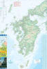
The Japan West & Kyushu Travel Map is a high-precision, field-tested cartographic guide engineered for independent travelers, rail enthusiasts, and road-trippers exploring the cultural and natural wonders of Western Japan. Published at a detailed 1:550,000 scale, this double-sided folded travel map combines comprehensive transportation networks with rich tourist information to make navigating Chugoku, Kansai, and the entire island of Kyushu simple and reliable.
Comprehensive Western Japan Mapping: Captures the full expanse of Western Japan, covering key destinations across Kyushu (Fukuoka, Nagasaki, Kumamoto, Kagoshima, Beppu) and Western Honshu (Hiroshima, Miyajima, Okayama, Osaka, and Kyoto).
Rail & Transit Networks: Highlights high-speed Sanyo and Kyushu Shinkansen (Bullet Train) corridors, JR rail lines, private feeder railways, passenger ferry connections, and regional airport hubs for seamless itinerary planning.
Road & Expressway Corridors: Features primary expressways, toll highways, scenic coastal routes, and mountain pass drives for travelers exploring by rental car.
Cultural & Natural Landmarks: Clearly pinpoints UNESCO World Heritage sites, historic castles, volcanic peaks (Mount Aso, Sakurajima), famous onsen hot spring towns, national parks, and ancient shrines.
This map is designed to withstand frequent folding, humid climates, and daily outdoor use. Its convenient folded format opens quickly for macro-route planning and folds down neatly into a daypack, jacket pocket, or glovebox.
Whether you are hopping bullet trains along the Sanyo line, exploring thermal hot springs in Kyushu, or driving through historic coastal villages, the Japan West & Kyushu Travel Map is an essential offline reference for your journey.