QUESTIONS? CALL OR TEXT! 1 (877) 921-6277 or (403) 266-2241
WE SHIP EVERYWHERE!


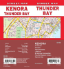
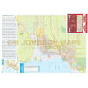
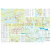
Explore the vast and rugged terrain of the Sunset Country and Superior North with the Kenora and Thunder Bay Detailed Street Map. This specialized regional resource is the most comprehensive guide for Northwestern Ontario, providing essential coverage for major hubs and remote townships alike. This map includes detailed street-level data for Kenora, Thunder Bay, Dryden, Fort Frances, and Sioux Lookout.
Designed for cross-border travelers and local residents, the map also features International Falls, MN, along with key regional centers such as Atikokan, Geraldton, Ignace, and Longlac. Stay on course with clearly defined road designations and transportation networks that connect the Trans-Canada Highway to local municipal routes. This map is an invaluable tool for identifying jurisdictional boundaries, government services, and cultural centers throughout the northwest, ensuring you have the geographic context needed for professional logistics or recreational travel.