QUESTIONS? CALL OR TEXT! 1 (877) 921-6277 or (403) 266-2241
WE SHIP EVERYWHERE!



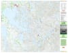
Embark on an unforgettable wilderness expedition into the heart of the Canadian Shield with the premium Lac La Ronge Provincial Park Map. Specifically engineered at a comprehensive 1:100,000 regional scale, this large-format topographic map is the definitive visual navigation asset for backcountry canoeists, wilderness anglers, backcountry campers, and outdoor adventurers. Spanning a generous 32" x 41.5", the map utilizes advanced shaded relief paired with sharp contour lines to vividly bring the park's rugged boreal landscapes, complex shorelines, and thousands of glaciated islands to life.
Because navigating the vast waters of north-central Saskatchewan requires absolute accuracy, this high-contrast map serves as an invaluable, signal-free safety guide where cellular reception is completely nonexistent. It delivers the precise aquatic and terrestrial data required to plan multi-day island-hopping loops, locate hidden portage trails, and safely traverse the massive open-water expanses of Lac La Ronge.
Official Churchill River & Lac La Ronge Canoe Routes: Clearly traces historic wilderness water trails, portage lengths, and recommended wilderness travel corridors across the lake and surrounding river systems.
Lac La Ronge Nautical Markers: Features critical water navigation details, including primary boat channels, shoals, and nautical markers to protect your watercraft hull from underwater hazards.
Backcountry & Drive-In Infrastructure: Pinpoints all front-country vehicle campgrounds (including Nut Point, Wadin Bay, and Missinipe), remote boat launches, floatplane bases, backcountry island campsites, and wilderness day-use shelters.
Printed on high-quality, high-contrast presentation paper, this map comes professionally folded inside a protective plastic sleeve to shield it from dirt, grease, and light rain while packed in your canoe barrel or hiking pack. Whether you are fishing for trophy lake trout, tracing ancient fur-trade routes along the nearby Churchill River system, or camping under the northern lights, this map is your ultimate companion.