QUESTIONS? CALL OR TEXT! 1 (877) 921-6277 or (403) 266-2241
WE SHIP EVERYWHERE!


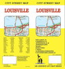
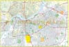

Navigate the "Gateway to the South" with the most comprehensive Louisville, Kentucky Street Map. Whether you are a local resident, a business professional, or a visitor in town for the Kentucky Derby, this detailed street guide provides the clarity and regional scope needed to master the Louisville Metro area.
This map offers unmatched coverage, extending from the historic downtown "Whiskey Row" and Museum Row across the Ohio River into Southern Indiana, including New Albany, Jeffersonville, and Clarksville.
Key Features & Regional Coverage:
Extensive Suburban Index: Detailed street-level mapping for over 80 municipalities and neighborhoods, including St. Matthews, Jeffersontown, Lyndon, Prospect, Shively, and Middletown.
Iconic Landmarks: Easily locate world-famous sites such as Churchill Downs, the Louisville Slugger Museum & Factory, the Muhammad Ali Center, and the Cave Hill Cemetery & Arboretum.
Major Transportation Hubs: Clearly marked interstates (I-64, I-65, I-71, I-264, I-265), the Louisville Muhammad Ali International Airport (SDF), and major parkways like Hurstbourne and Watterson.
Parks & Recreation: Navigate the expansive Louisville Loop and Olmsted-designed gems like Cherokee Park, Iroquois Park, and the Waterfront Park.
Southern Indiana Connectivity: Includes seamless street transitions for Clark and Floyd Counties, covering Utica and Sellersburg.
Engineered for legibility and ease of use, this map is the perfect tool for real estate professionals, delivery services, and road-trippers exploring the heart of the Bluegrass State.