QUESTIONS? CALL OR TEXT! 1 (877) 921-6277 or (403) 266-2241
WE SHIP EVERYWHERE!

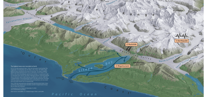


Commemorate the most powerful wave ever recorded in modern history with the 1958 Lituya Bay Mega-Tsunami Wall Map. Measuring 31x23 inches, this specialized cartographic study illustrates the cataclysmic event of July 9, 1958, when a magnitude 7.8 earthquake along the Fairweather Fault triggered a massive rockfall into the narrow waters of Lituya Bay, Alaska.
This map provides a detailed forensic look at the geography of the disaster, marking the precise location of the Gilbert Inlet rockslide and the subsequent trimline where the water reached an incredible height of 1,720 feet (524 meters). The high-resolution rendering showcases the rugged topography of Glacier Bay National Park, including the Fairweather Range and the surrounding glaciers. Whether for a geologist, a history buff, or an Alaskan resident, this map serves as a sobering and educational visual record of the raw power of nature. It features clear labels for the bay's entrance, Cenotaph Island, and the devastating "scouring" effect that stripped the mountainsides of all vegetation.