QUESTIONS? CALL OR TEXT! 1 (877) 921-6277 or (403) 266-2241
WE SHIP EVERYWHERE!

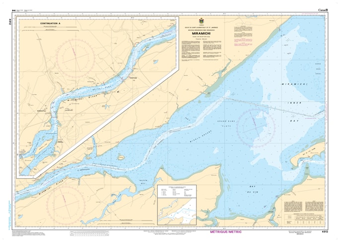
Navigate the historic and ecologically rich waters of New Brunswick's world-famous river system with our premium-grade marine map covering the Miramichi River. This highly detailed nautical chart is an indispensable resource for commercial vessel operators, river pilots, recreational boaters, and avid salmon fishermen tracking the winding channels and tidal reaches of this iconic waterway.
Featuring precise depth soundings, clear shoreline topography, river markers, and accurate tracking of local sandbars, islands, and bridge clearances, this map provides the essential tactical clarity required for safe river navigation. Whether you are guiding a vessel upriver, exploring traditional fishing pools, or looking for a striking piece of regional artwork to frame for your home, fishing lodge, or office, this map beautifully blends functional reliability with visual excellence. Printed on high-quality, durable media, it is designed to withstand active onboard use or serve as a long-lasting display piece celebrating the deep maritime and cultural heritage of the Miramichi region.