QUESTIONS? CALL OR TEXT! 1 (877) 921-6277 or (403) 266-2241
WE SHIP EVERYWHERE!

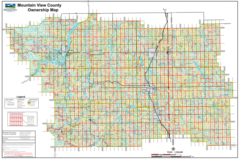


The Mountain View County Landownership Map is an essential reference tool for land professionals, agricultural producers, energy developers, and rural residents in Central Alberta. Positioned between Calgary and Red Deer, Mountain View County features a rich mix of farmland, ranching, energy infrastructure, and scenic foothill landscapes.
This detailed cadastral map provides clear surface land ownership identification, labeling each quarter section with the current registered owner’s name. Distinct color-coding allows users to immediately navigate land status across the municipality:
Freehold (Private): Standard titled private land parcels.
Crown (Government): Provincial and federal public lands.
Crown Leased: Government lands under active agricultural, grazing, or industrial lease.
Key Features:
Updated Transportation Grid: Precise road network rendering, including Township Roads, Range Roads, local access routes, and major highways.
Urban Centers & Communities: Full geographic coverage of towns and villages, including Olds, Didsbury, Carstairs, Sundre, and Cremona.
Natural Geography & Recreation: Accurately highlights local lakes, rivers, creeks, regional parks, and municipal recreational areas.
Whether you are evaluating real estate opportunities, conducting site assessments for surface rights, managing agricultural logistics, or navigating rural roads, this map offers accurate and accessible spatial data.