QUESTIONS? CALL OR TEXT! 1 (877) 921-6277 or (403) 266-2241
WE SHIP EVERYWHERE!

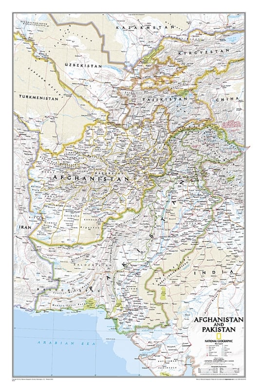
Gain a deep, comprehensive understanding of a geopolitically vital and historically complex region with the authoritative National Geographic Afghanistan and Pakistan Classic Wall Map. This premium-grade reference map showcases the signature, award-winning cartography that has defined National Geographic for generations. Featuring the iconic "Classic" color palette—characterized by crisp blue oceans and softly tinted, contrasting country boundaries—this map delivers an optimal balance between rigorous academic utility and sophisticated presentation.
Spanning a meticulously detailed layout, this map provides unmatched geographic clarity across Afghanistan, Pakistan, and their immediate neighboring territories. It features up-to-date international borders, contested boundary lines, thousands of accurately placed place names, major capital cities, and primary transportation networks including vital highways and regional roads.
Navigators, historians, and international relations professionals will appreciate the masterful rendering of the region's rugged topography. The map utilizes stunning shaded relief to illustrate the imposing peaks of the Hindu Kush and Karakoram mountain ranges, the desolate desert basins of Balochistan, and critical geographic corridors like the Khyber Pass. Printed on heavy-duty, premium-grade paper stock, this striking wall map serves as a powerful standalone focal piece and an invaluable educational or analytical resource for any office, study, or classroom.
Click to see a zoomed in view of this map...