QUESTIONS? CALL OR TEXT! 1 (877) 921-6277 or (403) 266-2241
WE SHIP EVERYWHERE!

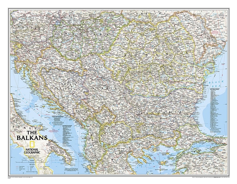
Navigate the complex political geography and rich historical landscapes of Southeastern Europe with the authoritative National Geographic Balkans Political Wall Map. This premium-grade reference map features National Geographic’s award-winning cartography, delivering unmatched academic detail wrapped in a clean, highly legible presentation. It serves as an essential analytical and educational tool for corporate boardrooms, international relations offices, university classrooms, or home studies.
Designed for high-impact visual clarity, this comprehensive map offers an exhaustive look at the Balkan Peninsula and its surrounding nations. The layout features thousands of accurately placed place names, precisely defined international boundaries, and critical regional infrastructure networks—including primary highways, secondary roads, shipping canals, international ferry routes, and major passenger railroads. To provide deep administrative context, the map includes specialized reference listings for the individual counties of Hungary and Romania along with their respective capitals, alongside the complex internal administrative divisions of Bosnia and Herzegovina.
Geographers, historians, and travel enthusiasts will appreciate the masterful physical rendering of the region's notoriously rugged landforms. The map utilizes stunning shaded relief to illustrate towering mountain networks like the Carpathians, Balkans, and Dinaric Alps, complete with major peak elevations expressed in meters. Coastal bathymetry and precise ocean depth soundings map the floor of the surrounding Adriatic, Ionian, and Black Seas
Core Balkan & Central European Nations: Albania, Austria, Bosnia and Herzegovina, Bulgaria, Croatia, Hungary, Kosovo, North Macedonia, Moldova, Montenegro, Romania, and Slovenia.
Outlying Border Countries: Greece, Italy, Slovakia, Serbia, Turkey, and Ukraine.
Printed on heavy-duty, premium-grade paper stock, this striking wall map transitions effortlessly from a powerful geographic research guide to a sophisticated piece of international travel decor.
Click to see a zoomed in view of this map...