QUESTIONS? CALL OR TEXT! 1 (877) 921-6277 or (403) 266-2241
WE SHIP EVERYWHERE!

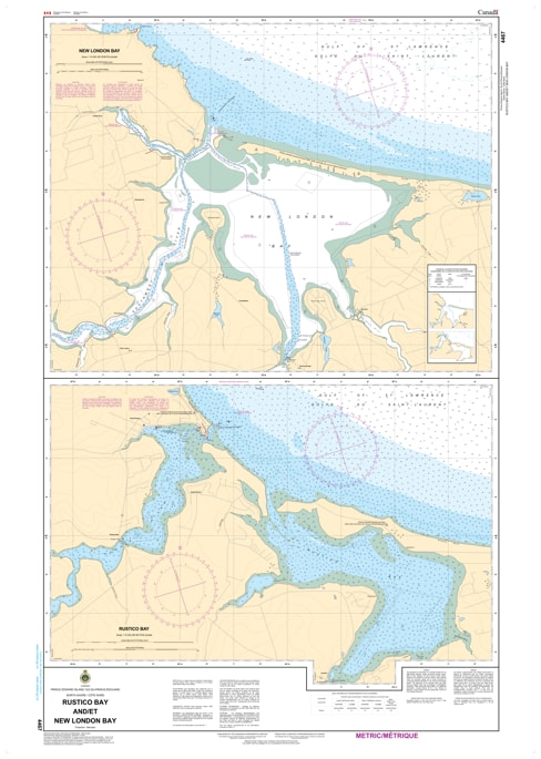
Navigate the iconic and ever-changing coastline of the Prince Edward Island National Park with the specialized detail of CHS Nautical Chart 4467. Providing high-resolution coverage of Rustico Bay and New London Bay, this chart is an essential resource for mariners traversing the shallow, tide-sensitive inlets of PEI’s North Shore. These bays are famous for their shifting sandbars, narrow entrance channels, and vibrant fishing communities, requiring the precise hydrographic data found only in official Canadian Hydrographic Service documents.
Chart 4467 features large-scale mapping of the Rustico Harbour entrance and the expansive waters of New London Bay, including the mouths of the Hope, Stanley, and Southwest Rivers. Whether you are a commercial fisher out of North Rustico, a recreational boater exploring the scenic "Green Gables" shore, or a researcher monitoring the fragile barrier beach systems, this chart offers the soundings, navigational aids, and shoreline detail necessary for safe transit through these coastal lagoons.
Key Features include:
Dual Bay Coverage: Detailed mapping of both Rustico Bay and New London Bay, including the intricate inner basins and tidal estuaries.
Hydrographic Accuracy: Features precise depth soundings and seabed composition essential for navigating the notoriously shallow and shifting "bars" at the harbour mouths.
Navigational Infrastructure: Clearly identifies the Rustico breakwaters, New London range lights, and the seasonal buoyage required for safe entry.
National Park Shoreline: Meticulously records the contours of the Cavendish and Stanhope dunes and the coastal transition of Queens County.
Professional Grade: Produced to the rigorous standards of the Canadian Hydrographic Service (CHS) for professional navigation, maritime safety, and GIS spatial analysis.