QUESTIONS? CALL OR TEXT! 1 (877) 921-6277 or (403) 266-2241
WE SHIP EVERYWHERE!

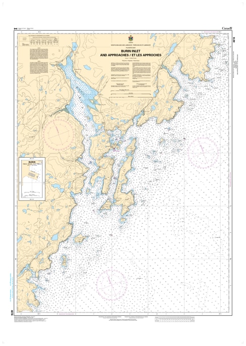
Navigate the historic and sheltered waters of the Burin Peninsula with Nautical Chart 4616. This critical hydrographic map provides high-resolution coverage for Burin Harbours and Approaches, offering the detailed data required to safely transit the complex inlets, islands, and narrow reaches that define this legendary Newfoundland port.
Chart 4616 is an essential resource for mariners entering Burin Inlet, featuring large-scale harbor plans for Great Burin, Ship Cove, and the surrounding coastal passages. It includes precise bathymetric soundings, identifies treacherous rocky ledges and shoals, and provides the exact positioning of all navigational aids. Whether you are a commercial vessel heading for the Burin shipyards or a coastal cruiser navigating the rugged south coast of Newfoundland, this chart offers the professional accuracy needed to handle the area's challenging tides and intricate topography.
Key Features:
Large-Scale Harbour Detail: Provides specialized mapping for the Burin Harbours, including in-depth views of docks, wharves, and sheltered anchorages.
Hydrographic Precision: Features updated depth contours and hazard markings essential for navigating the narrow "Reaches" around Burin.
South Coast Navigation: Clear identification of lights, buoys, and fog signals vital for safe entry during the region’s frequent low-visibility conditions.
Professional Grade: Designed with high-contrast markings for maximum readability on the bridge in all weather conditions.