QUESTIONS? CALL OR TEXT! 1 (877) 921-6277 or (403) 266-2241
WE SHIP EVERYWHERE!

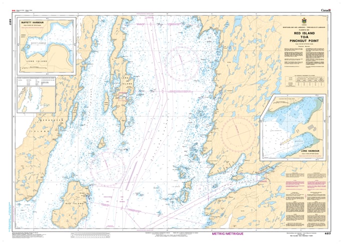
Navigate the central waters of Placentia Bay with the precision of Nautical Chart 4617. This official hydrographic map provides essential coverage for the coastal and offshore transit between Red Island and Pinchgut Point, capturing a vital segment of Newfoundland’s southern maritime corridor.
Chart 4617 is designed for mariners operating in the challenging environment of the eastern Burin Peninsula and the central islands of the bay. It features high-resolution bathymetric soundings, clearly identifies the rugged underwater ledges and rocky shoals that define this coastline, and marks the safe passages around Red Island. Whether you are navigating commercial shipping lanes or local fishing grounds, this chart provides the professional accuracy required to manage the powerful Atlantic swells and frequent fog common to the Placentia Bay region.
Key Features:
Comprehensive Coastal Coverage: Maps the waters from the offshore prominent feature of Red Island to the shoreline at Pinchgut Point.
Hydrographic Precision: Includes updated depth contours, reef locations, and essential navigational aids for the central Placentia Bay area.
Safety & Navigation: Highlights submerged hazards and provides clear marking of lights and buoys necessary for safe transit.
Newfoundland South Coast Essential: A primary resource for vessels navigating between the outer bay and the industrial hubs further north.