QUESTIONS? CALL OR TEXT! 1 (877) 921-6277 or (403) 266-2241
WE SHIP EVERYWHERE!

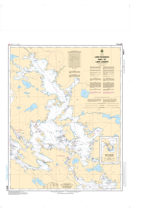
Complete your navigation toolkit for Ontario’s "Big Three" lakes with Nautical Chart 6022. This essential hydrographic map provides high-resolution coverage of both Lake Rosseau and Lake Joseph, delivering the intricate detail required to safely pilot the deep waters, narrow channels, and island-heavy bays of upper Muskoka.
Chart 6022 is a vital resource for navigating the scenic corridor from Port Carling through to the northern reaches of Lake Joseph. It features precise bathymetric soundings for the region's famous deep basins, identifies hazardous submerged rocks and shoals, and provides clear markings for the small craft routes. Whether you are navigating the Joseph River, exploring the Shadow River, or docking at one of the historic resorts, this chart ensures you have professional-grade data for a safe journey.
Key Features:
Dual Lake Coverage: Comprehensive mapping of both Lake Rosseau and Lake Joseph on a single detailed chart.
Hydrographic Precision: Updated depth contours and shoreline features essential for maneuvering around the lakes' many private islands.
Navigation & Safety: Clearly identifies all buoys, light markers, and potential hazards unique to these high-traffic recreational waters.
The Definitive Guide: Essential for boaters using the Port Carling or Port Sandfield locks to transit between the Muskoka lakes.