QUESTIONS? CALL OR TEXT! 1 (877) 921-6277 or (403) 266-2241
WE SHIP EVERYWHERE!

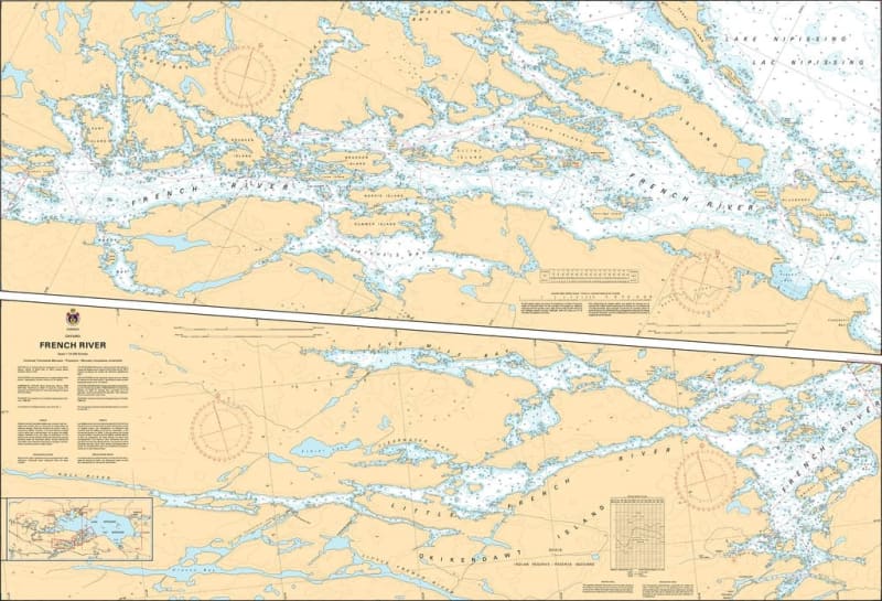
Navigate one of Canada’s most historic and scenic waterways with Nautical Chart 6036. This official hydrographic map provides essential, high-resolution coverage for the French River, a designated Canadian Heritage River that serves as the critical link between the western end of Lake Nipissing and the North Channel of Georgian Bay.
Chart 6036 is an indispensable tool for mariners traversing the river’s complex network of narrow channels, rocky islands, and secluded bays. Given the river’s characteristic Canadian Shield topography, the chart features precise bathymetric soundings to identify treacherous submerged rocks and varying depth contours. It provides detailed mapping for key navigational points, including current flow indicators, safe boat passage routes, and the location of essential navigational aids. Whether you are embarking on a legendary canoe expedition or navigating a powerboat through the river’s intricate reaches, this chart offers the professional-grade accuracy required for safe pilotage through this rugged wilderness corridor.
Key Features:
Complete Riverine Coverage: Detailed mapping of the French River system, providing the primary link between Lake Nipissing and Georgian Bay.
Hydrographic Precision: Features updated depth data and identifies hazardous rocky shoals and underwater obstructions.
Heritage Waterway Navigation: Includes markings for safe channels, rapids, and sheltered inlets vital for both motorized and paddle craft.
Safety & Pilotage: Clear identification of lights, buoys, and landmarks necessary for navigating the river’s frequent twists and narrow passages.