QUESTIONS? CALL OR TEXT! 1 (877) 921-6277 or (403) 266-2241
WE SHIP EVERYWHERE!

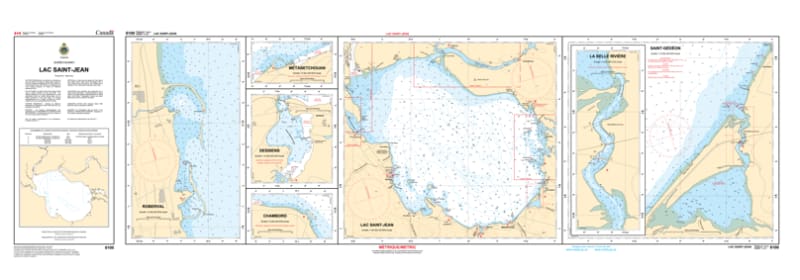
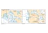
Explore the "Inland Sea" of Quebec with the comprehensive Nautical Chart 6100. This essential collection consists of four detailed maps on a single sheet, providing total hydrographic coverage for Lac Saint-Jean. From the mouth of the Saguenay River to the western shores of Roberval and Saint-Félicien, this chart is the definitive guide for navigating one of Quebec's most iconic bodies of water.
Chart 6100 is designed for the specific needs of boaters, sailors, and anglers navigating these vast but often shallow waters. It features high-resolution bathymetric data, identifying the shifting sandbars and rocky shoals common near the mouths of the Mistassini and Ashuapmushuan rivers. The map set provides clear detail for municipal marinas, public wharves, and seasonal navigational aids across the entire lake. Whether you are cruising between Alma, Roberval, and Dolbeau-Mistassini or fishing for the legendary landlocked salmon (ouananiche), this chart offers the professional accuracy required for safe pilotage.
Key Features:
Complete 4-Map Set: Offers multi-panel coverage of the entire lake, including specialized views of major ports and river entrances.
Hydrographic Precision: Features updated depth contours and bottom characteristics essential for the variable depths of Lac Saint-Jean.
Safety & Navigation: Clear marking of buoyed channels, submerged hazards, and essential lights for safe day and night transit.
Regional Essential: The primary maritime resource for the Saguenay–Lac-Saint-Jean region, supporting both recreational and commercial traffic.
Coverage: Entirety of Lac Saint-Jean, QC.
Format: Multi-map sheet (4 detailed plans).
Primary Locations: Roberval, Saint-Félicien, Alma, Chambord, and Péribonka.