QUESTIONS? CALL OR TEXT! 1 (877) 921-6277 or (403) 266-2241
WE SHIP EVERYWHERE!

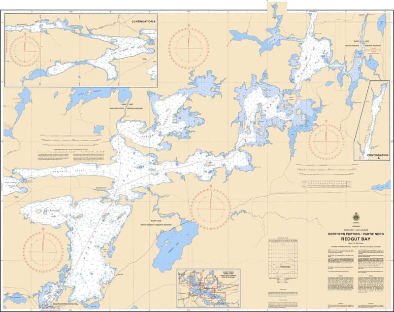
Navigate the secluded and legendarily productive waters of the East Arm with Nautical Chart 6110. This official Canadian Hydrographic Service (CHS) map provides specialized, high-resolution coverage of Redgut Bay, one of the most popular destinations on Rainy Lake for anglers and wilderness boaters seeking shelter from the open waters of the main basin.
Redgut Bay is renowned for its complex shoreline and island-heavy geography, which demands the precise bathymetric soundings found on Chart 6110. The map identifies the sharp depth transitions and submerged rocky hazards that are characteristic of this Canadian Shield bay. It provides the exact positioning of all navigational aids, ensuring safe passage through narrow narrows and around hidden reefs. Whether you are a local lodge guest, a dedicated walleye angler, or a recreational boater exploring the scenic inlets of the East Arm, this chart provides the professional-grade detail required for safe and successful pilotage in this remote Ontario waterway.
Key Features:
Dedicated Bay Coverage: Detailed mapping specifically for Redgut Bay, including its various arms and connecting channels.
Hydrographic Precision: Features updated depth contours and bottom characteristics essential for navigating the bay’s intricate underwater landscape.
Safety & Navigation: Clear identification of hazardous shoals, rocky points, and essential buoyage for safe transit.
Angling Essential: The definitive map for fishers navigating the productive weed lines and rock structures of eastern Rainy Lake.
Region: East Arm of Rainy Lake, Ontario.
Primary Coverage: Redgut Bay and surrounding islands.
Format: Available in standard paper or high-durability waterproof prints.