QUESTIONS? CALL OR TEXT! 1 (877) 921-6277 or (403) 266-2241
WE SHIP EVERYWHERE!



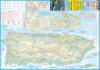
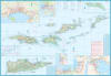
Experience the ultimate Caribbean getaway with the authoritative, double-sided Puerto Rico & US Virgin Islands Travel Reference Map. Meticulously compiled for independent road-trippers, island-hopping backpackers, sailors, and resort travelers, this premium regional map delivers seamless, uninterrupted geographic coverage of America's breathtaking Caribbean territories. Whether you are navigating the historic, blue-cobblestoned streets of Old San Juan, driving the panoramic mountain routes of the Cordillera Central, or taking a ferry across to the pristine shores of St. Thomas, St. John, and St. Croix, this detailed cartographic guide ensures you travel with absolute confidence.
This map brilliantly balances broad regional perspective with micro-level urban and maritime accuracy, ensuring you never lose your bearings while navigating scenic coastal highways or locating remote ferry terminals.
Side One (Puerto Rico): Features a comprehensive, high-contrast road network across the entire main island—including the primary autopistas, scenic secondary routes, and winding mountain roads—plus dedicated coverage of the offshore island municipalities of Vieques and Culebra.
Side Two (US Virgin Islands): Delivers highly detailed mapping of St. Thomas, St. John, and St. Croix, making it an indispensable resource for exploring Virgin Islands National Park or driving the scenic coastal loops.
High-Precision Urban Street Insets: Includes detailed, annotated urban street plans to seamlessly guide you through major cultural and historic hubs, including San Juan, Ponce, and Charlotte Amalie.
100% Waterproof & Tear-Resistant Synthetic Paper: Engineered specifically to withstand the rigors of tropical travel. This map won't fall apart when exposed to heavy humidity, sudden Caribbean downpours, saltwater spray, or frequent folding at the beach.
Packed with Points of Interest: Features intuitive icons identifying white-sand beaches, premier scuba diving and snorkeling coral reefs, ferry routes, historic Spanish forts, bioluminescent bays, hiking trails in El Yunque National Forest, and local airports.
Measuring an expansive layout when unfolded, this map folds down effortlessly into a compact, pocket-friendly travel format that fits perfectly in your daypack, glovebox, or dry bag. Complete with an exhaustive index and an easy-to-read multilingual legend, it stands as your indispensable, signal-free safety companion across the radiant islands of the Caribbean.