QUESTIONS? CALL OR TEXT! 1 (877) 921-6277 or (403) 266-2241
WE SHIP EVERYWHERE!

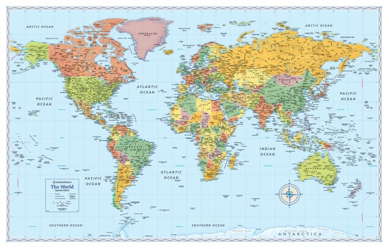
The Political World Wall Map by Rand McNally is a sophisticated cartographic masterpiece designed for those who demand both accuracy and aesthetic appeal. Utilizing the Gall Stereographic projection, this map solves the common problem of distortion by maintaining the relative sizes of countries and continents, providing a more realistic and balanced representation of the Earth’s surface compared to traditional projections.
With a unique design that places Africa as the central point, this map allows for a continuous view of all continents in their intact form, fostering a deeper understanding of global spatial relationships. The map isn't just about borders; it features color-matching relief that visually emphasizes mountain ranges and elevation changes, allowing the Earth's topography to practically jump off the page.
Whether used as a powerful educational tool or a professional reference, the map is built for clarity and precision:
Detailed Cartography: Clearly labeled country names, capitals, and major cities for effortless identification.
Geospatial Tools: Includes precise latitude and longitude indications for advanced positioning and navigation.
Modern & Bold: Vibrant colors and bold styling ensure the map remains visually captivating while reflecting the most current geopolitical landscape.
Versatile Decor: Its sophisticated design makes it a striking decorative piece, perfect for framing in a home, office, or classroom setting.
Experience a visual gateway to the world that encourages curiosity and a deeper appreciation for our interconnected global landscape.