QUESTIONS? CALL OR TEXT! 1 (877) 921-6277 or (403) 266-2241
WE SHIP EVERYWHERE!


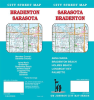
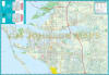
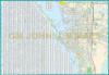
Navigate Florida’s stunning Suncoast with the most comprehensive Sarasota & Bradenton City Street Map. This detailed guide is an essential resource for residents and visitors alike, offering extensive coverage of the coastal and inland corridors across both Manatee and Sarasota Counties. From the historic fishing village of Cortez to the upscale shops of St. Armands Circle, this map ensures you never miss a turn in this vibrant Gulf Coast region.
Comprehensive Regional Coverage Includes:
Beach & Barrier Islands: Complete street-level detail for Anna Maria Island, Bradenton Beach, Holmes Beach, and the entirety of Longboat Key.
Urban Hubs: Detailed navigation for Bradenton, Palmetto, and partial coverage of the Sarasota city center.
Cultural & Nature Landmarks: Easily locate world-class attractions such as The Ringling Museum of Art, Marie Selby Botanical Gardens, Mote Marine Laboratory, and the Bishop Museum of Science and Nature.
Recreation & Waterfronts: Navigate with ease to the Bradenton Riverwalk, Village of the Arts, and popular beach access points along the Gulf of Mexico.
Logistics & Transit: Clearly marked highways (I-75, US-41/Tamiami Trail), the Sarasota Bradenton International Airport (SRQ), and major bridges connecting the mainland to the keys.
Whether you are scouting real estate in Lakewood Ranch or planning a day trip to the powdery sands of Siesta Key, this map provides the reliable, big-picture clarity required for professional and recreational travel.