QUESTIONS? CALL OR TEXT! 1 (877) 921-6277 or (403) 266-2241
WE SHIP EVERYWHERE!


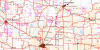
The Professional Saskatchewan Base Map: 1:750,000 DLS Reference
This highly-detailed, aesthetic Saskatchewan wall map is an indispensable tool for land management, real estate, and resource exploration professionals. At a unique 1:750,000 scale, it offers greater detail than standard provincial maps while still covering the entire province of Saskatchewan.
Key Land Survey & Grid Features:
Dominion Land Survey (DLS) Grid: The map prominently features the full DLS grid, clearly marking all townships and sections. This is crucial for precise land location in agricultural and oil & gas operations throughout the southern and central regions.
Geographic Coordinates: Includes a one-degree Geographic grid for easy referencing of latitude and longitude coordinates, making it fully compatible with modern GPS and GIS systems.
Comprehensive Geographic and Administrative Detail:
This easy-to-read provincial map is perfect for office reference and depicts a wide array of features, including:
Major and secondary primary roads
All major places (cities, towns, villages, and unincorporated areas)
Hydrographic features (rivers and lakes)
Important boundaries like provincial parks, military reserves, and Native reserves (or First Nations reserves).