• QUESTIONS? CALL OR TEXT! 1 (877) 921-6277 or (403) 266-2241

  • WE SHIP EVERYWHERE!

Navigate to the undefined homepage

Prices are in Canadian funds

Home >
Saskatchewan Wall Map 1:1,000,000 showing Rural Municipality Boundaries and DLS Township Grid
Saskatchewan Wall Map 1:1,000,000 showing Rural Municipality Boundaries and DLS Township Grid - Image 1 of 0
Saskatchewan Wall Map 1:1,000,000 showing Rural Municipality Boundaries and DLS Township Grid - Image 2 of 0
Saskatchewan Wall Map 1:1,000,000 showing Rural Municipality Boundaries and DLS Township Grid - Image 3 of 0

Saskatchewan Base Map 1:1,000,000 - RM Boundaries, DLS Township & Geographic Grid Wall Map

MapTown
$
Choose your options:
Style(optional):
Product Code: 644999

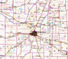
The Definitive Saskatchewan Provincial Base Map (1:1,000,000 Scale)

This detailed and aesthetic Saskatchewan wall map is engineered to meet the highest demands of professionals in resource management, agriculture, and municipal planning. Covering the entire province of Saskatchewan at a 1:1,000,000 scale, this is the most comprehensive single map for administrative and survey reference.

Key Administrative & Survey Features:

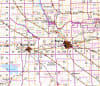
  • Rural Municipalities (RMs): Clearly displays all Saskatchewan Rural Municipality boundaries for provincial planning and administrative reference. This is an essential feature for anyone needing a detailed SK RM map.

  • Dominion Land Survey (DLS) Grid: Features the full DLS grid, including all townships and sections, vital for land surveying, real estate, and agricultural use.

  • Geographic and Naming Convention: Includes a one-degree Geographic grid for precise latitude and longitude coordinates across the province.

Comprehensive Geographic Detail:

The map is an easy-to-read reference that depicts all major communities (cities, towns, villages, unincorporated areas), primary roads, major rivers and lakes, provincial parks, military reserves, and Native reserves. Perfect for the office, classroom, or as a striking wall display.

36 Inches by 53 InchesScale: 1:1,000,000
Empty Cart