QUESTIONS? CALL OR TEXT! 1 (877) 921-6277 or (403) 266-2241
WE SHIP EVERYWHERE!


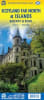
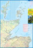
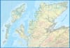
Explore the rugged Highlands and remote coastal archipelagos of Northern Scotland with the Scotland Far North & Islands Travel Map. Designed for road-trippers, coastal drivers, and outdoor travelers, this detailed regional map provides essential cartographic coverage for navigating the North Coast 500 (NC500), the Orkney Islands, the Shetland Islands, and the Outer Hebrides.
Engineered with clear topographic rendering and road networks, this map ensures reliable navigation across Scotland’s most picturesque and isolated terrain.
Topographic & Hydrographic Detail: Features precise spot elevations, mountain contours, lochs, coastal fjords, and river networks for comprehensive terrain reference.
Road & Transport Network: Highlights primary motorways, scenic single-track A and B roads, driving routes, and vital ferry connection lines between the mainland and island chains.
Iconic Tourist Points of Interest: Utilizes an intuitive legend with distinct icons pinpointing historic castles, ancient ruins, whisky distilleries, campsites, viewpoints, and visitor centers.
Island & Highland Coverage: Combines the far northern mainland with complete mapping of Orkney, Shetland, Lewis, and Harris for seamless island-hopping adventures.
Whether driving the North Coast 500 or hopping ferries across the Northern Isles, this travel map is an indispensable guide for your Scottish journey.