QUESTIONS? CALL OR TEXT! 1 (877) 921-6277 or (403) 266-2241
WE SHIP EVERYWHERE!

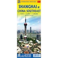
Navigate the economic powerhouse and breathtaking coastal landscapes of East China with the authoritative Shanghai & China South East Travel Reference Map. Purpose-built for business professionals, independent backpackers, cultural tourists, and regional logistics planners, this premium double-sided map offers a masterfully balanced look at China’s most dynamic economic corridor. By pairing a high-density urban street index for the global metropolis of Shanghai with a comprehensive regional road map of Southeast China, this cartographic guide ensures you travel with absolute confidence.
The double-sided layout perfectly isolates the sprawling mega-city from the interconnected coastal provinces, maximizing text legibility and completely eliminating map clutter.
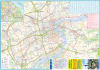
Side One (Shanghai City Street Plan): Features an ultra-detailed, highly readable street-level index of China's commercial capital at a crisp 1:16,000 scale. This comprehensive layout makes it effortless to navigate downtown districts, locate high-speed Maglev and metro transit lines, find luxury hotels, and walk to iconic landmarks like the Bund, Nanjing Road, and Pudong's towering skyscrapers.
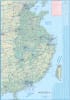
Side Two (Southeast China Regional Map): Zooms out to a comprehensive 1:2,400,000 regional scale, covering the dense transportation grids and historic landscapes of the surrounding southeastern provinces. It traces primary expressways, high-speed rail networks, and secondary roads connecting major manufacturing hubs and cultural epicenters.
Far more than a simple city atlas, this travel reference map is deeply overlaid with intuitive symbols pointing you directly to East China's premier commercial hubs, transportation networks, and historic landmarks. It features clear, high-accuracy mapping for:
Mass Transit Systems: Smooth navigation markers for international airports (Pudong and Hongqiao), major deep-water shipping ports, bullet train terminals, and intra-city subway connections.
Cultural & Historical Sites: Explicitly plots the routes and locations for historic water towns, ancient temples, museums, parks, and traditional gardens across the region.
Bilingual Toponymy: Features accurate place-names rendered in clear Latin script (Pinyin) with essential bilingual context to assist with local navigation, taxi communication, and ticket booking.
Printed on high-quality, high-contrast presentation paper, this large-format map folds down effortlessly into a compact, pocket-friendly travel size that fits perfectly in your daypack, briefcase, or travel glovebox. Complete with a comprehensive place-name index and an easy-to-read multilingual legend, it stands as your indispensable, signal-free safety companion through the cutting-edge hubs and historic landscapes of Southeast China.