QUESTIONS? CALL OR TEXT! 1 (877) 921-6277 or (403) 266-2241
WE SHIP EVERYWHERE!

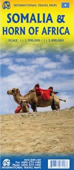
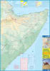

Explore one of the most geographically diverse and historically rich regions of East Africa with the Somalia & Djibouti - Horn of Africa Travel & Road Map. Designed specifically for international travelers, aid agencies, researchers, and regional logistics planners, this comprehensive map offers detailed coverage of both Somalia (the Federal Republic of Somalia) and the neighboring nation of Djibouti.
This highly accurate, double-sided reference map outlines the entire Horn of Africa region, bordered by Ethiopia to the west, the Gulf of Aden to the north, the Guardafui Channel and Somali Sea to the east, and Kenya to the southwest. It is packed with vital regional data, including:
Comprehensive Transportation Network: Highlights major highways, secondary roads, dirt tracks, and local routes connecting key regional hubs.
Detailed Settlements & Landmarks: Clearly labels major cities, rural towns, historical points of interest, and national parks.
Geographical & Terrain Features: Features shaded relief topography, intricately drawn river systems, coastlines, and crucial desert watering holes essential for regional travel.
User-Friendly Navigation Tools: Includes a comprehensive index of place names to quickly locate remote settlements, alongside detailed inset maps of key urban areas.
Whether you are coordinating logistics, conducting field research, or studying the complex geography of East Africa, this durable map serves as an indispensable, highly detailed contemporary reference.