QUESTIONS? CALL OR TEXT! 1 (877) 921-6277 or (403) 266-2241
WE SHIP EVERYWHERE!


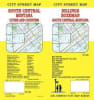
Navigate the sweeping mountain passes, expansive river valleys, and thriving urban centers of Big Sky Country with the authoritative South Central Montana Street Map by GM Johnson. Engineered specifically for interstate road-trippers, Yellowstone tourists, long-haul commercial drivers, and regional delivery fleets, this high-density fold map offers clean, uncompromised cartographic clarity across Montana's fastest-growing corridor.
South Central Montana features some of the most dramatic driving terrain in the Pacific Northwest, transitioning rapidly from the high plains of Billings to the towering alpine peaks surrounding Bozeman and the high-altitude volcanic plateaus of West Yellowstone. Rather than risking dropped cellular signals while traversing remote mountain highways or navigating complex mountain passes, this physical street map provides a highly scannable, permanent navigational safety net.
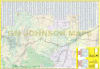
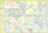
On one side, the map unveils a comprehensive, street-level layout of the region's primary metropolitan hubs, detailed down to local neighborhoods, industrial bypasses, and university sectors. Flip the sheet over to reveal a deep regional matrix of the surrounding counties, tracking major interstate corridors (I-90 and I-94), state highways, and backroads.
To ensure complete coverage of both high-traffic urban zones and remote outdoor recreation destinations, this map features highly detailed localized street insets for:
The Major Urban Hubs: Full urban street configurations, neighborhood grids, and commercial bypass layouts for Billings and Bozeman.
The Yellowstone & Gallatin Gateways: Essential, close-up tracking for West Yellowstone (the west entrance to the National Park), Livingston, Belgrade, and Big Sky Meadow Village.
Historic Foothill & Valley Communities: Precise street-level tracking for Laurel, Red Lodge (the gateway to the Beartooth Highway), Big Timber, Columbus, Roundup, and adjoining rural sectors.
Alpha-Numeric Street Index: Includes a comprehensive, easy-to-read cross-referenced layout, allowing you to instantly isolate obscure rural lanes, neighborhood avenues, and scenic mountain drives.
Point of Interest Directory: High-visibility indicators identify national park entrance stations, major trailheads, public campgrounds, regional airports, medical facilities, university campuses (including MSU), and county boundaries.
Glove-Box Ready Format: Cleanly folded to a compact, travel-friendly size designed to fit perfectly into standard vehicle console compartments, door pockets, or tactical travel packs.
| Attribute | Map Directory Profile |
| Publisher | GM Johnson Maps |
| Primary Core Cities | Billings & Bozeman, Montana |
| Regional Scope | South Central Montana wilderness and urban corridors |
| Key Insets Included | Belgrade, Big Sky Meadow Village, Big Timber, Columbus, Livingston, Laurel, Red Lodge, Roundup, West Yellowstone |
| Key Features Included | Complete street index, county boundaries, state park lines, airport flight paths |
| Format | Durable, high-utility fold-out paper map |