QUESTIONS? CALL OR TEXT! 1 (877) 921-6277 or (403) 266-2241
WE SHIP EVERYWHERE!


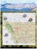
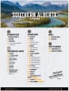
Unlock endless outdoor adventures with the Southern Alberta Backroad Mapbook, Canada’s bestselling guidebook for outdoor enthusiasts, road-trippers, and backcountry explorers. From the Canadian Rockies to the Badlands and southern prairies, this comprehensive guide delivers unmatched topographic mapping and backcountry detail.
Covering major regions including Calgary, Kananaskis Country, Canmore, Waterton Park, Drumheller, Cypress Hills Park, Crowsnest Pass, Lethbridge, Medicine Hat, Brooks, Fort Macleod, and High River, this mapbook is engineered to lead you far beyond the main highways.
Detailed Backroad & Industry Networks: Features up-to-date logging roads, resource roads, and gravel routes not found on standard road maps or GPS apps.
Extensive Trail Systems: Detailed mapping and descriptions for hiking, mountain biking, horseback riding, ATVing, and snowmobiling routes.
Comprehensive Adventure Listings: Detailed write-ups for local fishing lakes, paddling routes, wilderness campsites, roadside parks, and prime wildlife viewing spots.
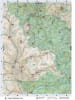
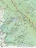
Topographic Precision: High-contrast relief shading, elevation contours, river systems, and land use boundaries for confident offline backcountry navigation.
Whether camping in Kananaskis, fly fishing in the Crowsnest Pass, or exploring the badlands near Drumheller, the Backroad Mapbook is your ultimate field guide to Southern Alberta.