QUESTIONS? CALL OR TEXT! 1 (877) 921-6277 or (403) 266-2241
WE SHIP EVERYWHERE!


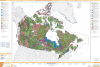
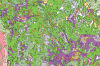
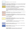
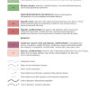
This 1:5,000,000 scale map is a masterpiece of Quaternary geology, detailing the distribution of surface materials and landforms across Canada. It is an essential reference for geologists, environmental engineers, and educators studying Canadian terrain.
Glacial Dynamics: Comprehensive mapping of glaciation extents and ice-flow directions, including historical glacial limits.
Sedimentary Deposits: Clearly identifies colluvial deposits, alluvial sediments, and glaciofluvial sediments.
Surface Composition: Detailed layers for weathered bedrock (regolith) and exposed bedrock.
Large Format: Printed at 40 x 58 inches, allowing for high-resolution legibility of complex geological boundaries.