QUESTIONS? CALL OR TEXT! 1 (877) 921-6277 or (403) 266-2241
WE SHIP EVERYWHERE!


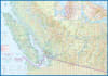
Discover the stunning coastlines, rugged mountain trails, and laid-back West Coast vibe of Southwestern British Columbia with our SW BC & The Sunshine Coast Travel & Road Map. Specially designed for road-trippers, hikers, paddlers, and coastal travelers, this detailed map is an indispensable navigation tool for exploring one of Canada's most captivating outdoor adventure regions.
Featuring precise cartographic detail and color-coded elevation contours, this map makes topographical planning effortless for mountain bikers and trail enthusiasts while offering a clear, comprehensive road network for scenic driving. Complete with a thorough index and detailed legend, navigating to points of interest, marine access points, and remote coastal parks has never been easier.
Featured Highlights & Regional Points of Interest:
Skookumchuck Narrows Provincial Park: Pinpoint the famous hiking trails and world-renowned tidal rapids.
Powell River: Easily navigate to historic coastal neighborhoods, local arts hubs, dining, and public beaches.
Smuggler Cove Marine Provincial Park: Find shoreline trails, footpaths, and marine accesses leading to rocky headlands and lush coastal forests.
Sechelt Inlets Marine Provincial Park: Chart top paddleboarding, sea kayaking, and marine wildlife viewing destinations across protected inlet waters.
Mount Daniel & Homesite Creek Provincial Park: Navigate mountain trailheads offering panoramic summit views of surrounding valleys and coastal ranges.
Plan your coastal escape with confidence using the ultimate travel reference for Southwestern BC and the Sunshine Coast.