QUESTIONS? CALL OR TEXT! 1 (877) 921-6277 or (403) 266-2241
WE SHIP EVERYWHERE!

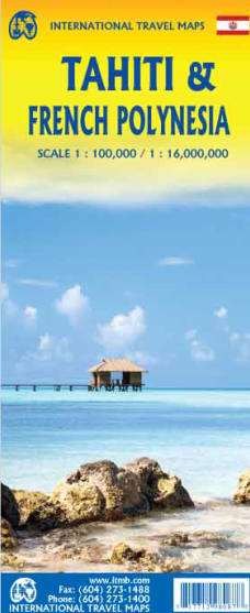

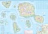
Embark on the ultimate South Pacific voyage with the Tahiti & Polynesian Cruising Travel Map. This meticulously detailed, double-sided map is an indispensable companion for island hoppers, cruise passengers, and sailors navigating the pristine waters of French Polynesia and the Cook Islands. Unlike standard regional maps, this layout provides comprehensive, high-resolution coverage of the entire Society Islands archipelago, allowing you to seamlessly transition from deep-sea cruising to onshore exploration.
Every tropical destination is brought to life using bright, high-contrast altitude coloring and precise topographic contour lines, vividly illustrating the dramatic volcanic peaks and lush valleys that define these islands. The map explicitly highlights top attractions, pristine coral reefs, ferry docks, airport strips, and maritime cruising routes. From the bustling streets of Papeete to the iconic overwater lagoons of Bora Bora and the remote shores of the Cook Islands, this cartographic guide ensures you can navigate both land and sea with complete confidence during your tropical escape.
This map features dedicated, high-detail layouts for the region's most spectacular islands and transit hubs:
Windward Islands: Full coverage of Tahiti Nui, Tahiti Iti, Moorea, and Maiao, including a detailed street-level inset of the capital city, Papeete.
Leeward Islands: Deep dives into the lagoons and topography of Bora Bora, Raiatea, Tahaa, Huahine, Maupiti, and Tupai.
Beyond the Society Islands: Complete regional mapping extending across the crystal-clear waters to include the Cook Islands.
Format: Double-sided print map (Optimized for maximum geographical coverage without bulk)
Cartography: Detailed physical topography with altitude color tinting, depth contours, and reef boundaries.
Navigation Essentials: Highlights major roads, maritime ferry corridors, international airports, cruise ship anchoring points, and luxury resort zones.
| Travel Element | Map Highlight | Practical Note |
| Topography | Bold Altitude Shading | Clearly illustrates hiking trails up volcanic peaks like Mount Otemanu. |
| Cruising Data | Maritime Transit Lines | Ideal for tracking your cruise ship's path or booking local inter-island ferries. |
| Onshore Guide | Point-of-Interest Icons | Instantly locate hidden beaches, archeological marae sites, and dive spots. |