QUESTIONS? CALL OR TEXT! 1 (877) 921-6277 or (403) 266-2241
WE SHIP EVERYWHERE!


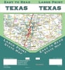
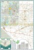
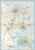
Map. Specially engineered for maximum legibility, this easy-to-read folded state map is a must-have tactical resource for anyone traveling in, around, or across Texas. Offering unbeatable accuracy and reliable route planning at a great price, it eliminates the eye strain of traditional, crowded highway maps, making it the perfect copilot for commercial truck drivers, RV road-trippers, and daily commuters alike.
This comprehensive map clearly displays all major Interstate, U.S., state, and county highways, alongside distinct markings for county boundaries, local airports, and key city streets. Beyond basic transit, it serves as an excellent travel guide, highlighting state parks, historic points of interest, and recreational areas across all 254 counties. Featuring an intuitive, easy-to-use legend and a detailed index, locating small towns, major metro hubs, or roadside stops is quick and effortless. To ensure it survives the rigors of the road, this map is printed on heavy-duty, water-resistant paper, protecting it from spills, tears, and frequent folding. Toss it in your glove box or center console for a dependable, battery-free navigation backup you can always count on.