QUESTIONS? CALL OR TEXT! 1 (877) 921-6277 or (403) 266-2241
WE SHIP EVERYWHERE!

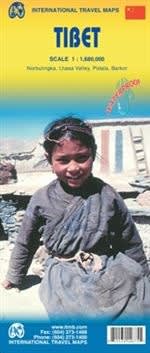

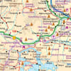
Embark on a spiritual and rugged journey to the Roof of the World with the authoritative, double-sided Tibet Travel Reference Map. Purpose-built for high-altitude trekkers, overland mountaineers, Buddhist pilgrims, and independent cultural travelers, this premium regional map delivers seamless cartographic coverage across the entire Tibetan Plateau. Featuring a comprehensive regional scale of 1:1,450,000, this specialized map provides the precise route tracking and extreme topographic context required to safely navigate remote mountain highways, high-altitude alpine passes, and historic pilgrimage trails.
The double-sided layout splits this sprawling, mountainous autonomous region strategically across both sides of the sheet, allowing for a highly readable index and clutter-free text entirely rendered in the Latin alphabet (Pinyin) alongside traditional regional names.
Advanced Relief Tinting: Uses vivid contour shading and peak elevation markers to accurately depict the dramatic, vertical terrain of the Himalayas, the Kunlun Mountains, and the vast Changtang plateau.
The Friendship Highway & Beyond: Explicitly charts the epic overland route from Lhasa to Kathmandu (Nepal), alongside secondary gravel roads, high-altitude passes ($5,000+\text{ meters}$), rail networks like the Qinghai–Tibet railway, and domestic airstrips.
Lhasa Capital City Inset: Features a detailed urban street-level inset of the historic capital, Lhasa, making it effortless to locate world-famous landmarks including the Potala Palace, Jokhang Temple, and the bustling Barkhor street circuit.
100% Waterproof & Tear-Resistant Synthetic Paper: Engineered specifically to withstand the harsh, unpredictable climate of the Tibetan Plateau. This map will not tear, stretch, or degrade when exposed to freezing mountain rain, heavy snowfall, intense UV radiation, or constant folding in high winds.
Deep Cultural Overlay: Features highly visible, intuitive iconography marking historic Tibetan monasteries (gompas), ancient fortresses (dzongs), sacred alpine lakes (such as Namtso and Yamdrok), basecamp staging zones for Mount Everest (Qomolangma), and the historic pilgrimage circuit around Mount Kailash.
Whether you are coordinating a long-distance 4x4 expedition across the plateau or tracking your steps along ancient trade routes, this map serves as an indispensable, signal-free safety asset for your pack.