QUESTIONS? CALL OR TEXT! 1 (877) 921-6277 or (403) 266-2241
WE SHIP EVERYWHERE!

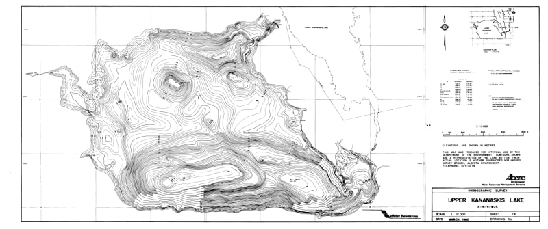
Unlock key underwater structure and elevate your fishing strategy in Peter Lougheed Provincial Park with the official hydrographic bathymetric chart for Upper Kananaskis Lake, Alberta. While standard topographic maps describe mountain elevations, bathymetric maps reveal underwater contour lines, detailing depth variations, sudden drop-offs, submerged plateaus, and deep basins across this glacier-fed reservoir.
For anglers targeting native Bull Trout, Rainbow Trout, and Cutthroat Trout, reading depth contours is essential for pinpointing prime feeding grounds. Steeply packed contour lines highlight underwater drop-offs where predatory fish ambush bait, while broad shallow contours reveal gravel flats perfect for spring foraging. Fisheries managers also rely on these hydrographic depth surveys to map fish habitats, analyze temperature stratification, and monitor population dynamics.
Whether you are scouting boat routes, pinpointing ice fishing hotspots, or looking for a detailed regional map of Kananaskis Country for your home or cabin, this print-on-demand chart offers outstanding spatial clarity. Printed on durable, heavy-duty media, it is built for active field use on the water or as an eye-catching wall display.