QUESTIONS? CALL OR TEXT! 1 (877) 921-6277 or (403) 266-2241
WE SHIP EVERYWHERE!



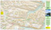
Venture deep into the backcountry with absolute navigation confidence using the official White Goat Wilderness Area Topographic Map. Engineered specifically for wilderness backpackers, day hikers, and remote hunters, this premium, high-resolution topographic map delivers exhaustive terrain and route detail for navigating this pristine wilderness zone. Printed at a highly detailed 1:50,000 scale, it provides the micro-level accuracy required to safely cross rugged mountain passes, track hidden valleys, and locate established campsites far off the beaten path.
This technical map utilizes stunning, state-of-the-art shaded relief combined with ultra-precise 25-meter and 100-meter contour intervals.
All primary and secondary access hiking trails with trailhead locations.
Backcountry campgrounds, designated campsites, and primitive staging areas.
Crucial hydrographic details including remote river systems, creek crossings, and alpine lakes.
Built to withstand the unpredictable elements of nature, this wilderness map comes securely packaged in a durable, protective plastic sleeve that keeps it clean and dry from rain, snow, and trail grime. Whether you are planning an intensive multi-day expedition or a remote backcountry trek, this paper map serves as an indispensable, signal-free safety resource for your pack.
NOTE - The paper version is sent folded, and the laminated version is shipped rolled in a tube.