Montana
Montana, the "Big Sky" state, is home to the glorious Flathead Lake and Glacier National Park. If you are interested in venturing deeper into the wilderness, Montana can accommodate you with boundless rugged terrain and natural forests.
National Geographic
National Geographic’s Trails Illustrated map of the Old Faithful area of Yellowstone National Park is designed to meet the needs of visitors with unmatched detail of the upper and midway geyser sections of the national park. Expertly researched and created in partnership with local land management agencies, this map features key points of interest including the Old Faithful geyser area, Midway Geyser Basin, Old Faithful, and Fountain Paint Pots. A list of recommend day hikes includes distances and difficulties. The Continental Divide Trail passes through this map.
National Geographic
National Geographic’s Trails Illustrated map of Two Medicine delivers unmatched detail and valuable information to assist you year-round in your exploration of southeastern Glacier National Park. Expertly researched and created in partnership with local land management agencies, this map includes helpful contact information, backcountry hiking and camping tips and regulations, snow hazard areas, safety tips, and more. The map features many key areas of interest including John Stevens Canyon, St. Mary's Lake, Lake McDonald and the historic Going-to-the-Sun road.
National Geographic
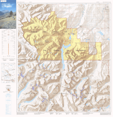
Created in partnership with local land management agencies, National Geographic’s Trails Illustrated map of Many Glacier, Glacier and Waterton Lakes National Parks offers unparalleled detail for outdoor enthusiasts exploring the pristine landscapes contained within these two spectacular parks. This expertly researched map features key areas of interest including Many Glacier, Upper Kintia Lake, Rising Sun, Saint Mary Lake, Belly River, and the Waterton Lakes.
National Geographic
National Geographic’s Trails Illustrated map of North Fork in Glacier National Park will benefit even the most experienced outdoors enthusiast, as you explore this pristine landscape that has very few amenities. Two additional maps for Many Glacier and the Two Medicine regions of the park along with a comprehensive Glacier National Park Trails Illustrated map are also available.Created in partnership with the National Park Service, U.S. Forest Service and others, this expertly researched map features key areas of interest such as Bowman Lake, Lake McDonald Valley, Goat Haunt and Avalanche Creek.
National Geographic
National Geographic’s Trails Illustrated map of the Tower and Canyon areas of Yellowstone National Park is designed to meet the needs of outdoor enthusiasts with unmatched detail of the north-east section of the national park. Expertly researched and created in partnership with local land management agencies, this map features key points of interest including Canyon Village, Roosevelt visitor area, North East Entrance Station, Gallatin National Forest, Custer National Forest, Shoshone National Forest, Absaroka-Beartooth Wilderness, and North Absaroka Wildereness.
National Geographic
National Geographic’s Trails Illustrated map of the Mammoth Hot Springs area of Yellowstone National Park is designed to meet the needs of outdoor enthusiasts with unmatched detail of the north-west section of the national park. Expertly researched and created in partnership with local land management agencies, this map features key points of interest including the Mammoth Hot Springs area, Canyon Village, South Entrance Station, West Yellowstone, Upper Yellowstone Falls, Gallatin National Forest, Absaroka-Beartooth Wilderness, and Lee Metcalf Wilderness.
National Geographic
National Geographic’s Trails Illustrated map of the Old Faithful area of Yellowstone National Park is designed to meet the needs of outdoor enthusiasts with unmatched detail of the south-west section of the national park. Expertly researched and created in partnership with local land management agencies, this map features key points of interest including the Old Faithful geyser area, the West Thumb of Yellowstone Lake, South Entrance Station, West Yellowstone, Heart Lake, and John D. Rockefeller Jr. Memorial Parkway. The Continental Divide Trail is also covered on this map.
National Geographic
National Geographic’s Trails Illustrated map of Glacier and Waterton Lakes National Parks offers unparalleled detail for outdoor enthusiasts exploring the pristine landscape of forests, mountains, lakes, and meadows within these two spectacular parks. Created in partnership with local land management agencies, this expertly researched map features key areas of interest including Many Glacier, Great Bear Wilderness, Flathead National Forest, Hungry Horse Reservoir, Lake McDonald, Flathead River, St. Mary Lake, Akamina-Kishinena Provincial Park, and the Waterton Lakes.
National Geographic
National Geographic’s Trails Illustrated map of Yellowstone National Park is designed to meet the needs of outdoor enthusiasts by combining valuable information with unmatched detail of America’s first national park. Expertly researched and created in partnership with local land management agencies, this map features key points of interest including Mammoth Hot Springs, Canyon Village, Yellowstone Lake, Yellowstone Falls, Grant Village, and Old Faithful geyser area.