QUESTIONS? CALL OR TEXT! 1 (877) 921-6277 or (403) 266-2241
WE SHIP EVERYWHERE!

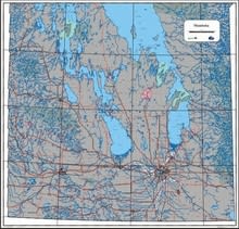
Navigate the heart of the prairies with the Manitoba Provincial Base Map South, a high-precision cartographic resource designed for regional planning and deep-territory exploration
This map serves as a definitive reference for Southern Manitoba’s intricate infrastructure and natural geography
Key Features:
Enhanced Scale Resolution: 1:500,000 scale provides superior detail of the Southern Manitoba region
Integrated Infrastructure: Comprehensive mapping of the full road network and provincial highways
Detailed Hydrology: Precisely delineates southern waterways, lakes, and river systems
Settlement Index: Includes all urban centers, rural towns, and small villages with clear population markers
Professional Cartography: Features a clean, professional layout suitable for wall mounting or desktop reference
High-Contrast Design: Optimized for easy reading of local road designations and geographic boundaries