QUESTIONS? CALL OR TEXT! 1 (877) 921-6277 or (403) 266-2241
WE SHIP EVERYWHERE!

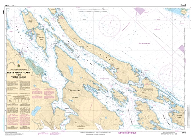
Navigate the scenic and intricate waterways of the central Salish Sea with the professional authority of the Canadian Hydrographic Service (CHS). Chart 3442 is the indispensable "road map" for mariners exploring the diverse coastline between the northern tip of Pender Island and the narrow passages surrounding Thetis Island.
The central Gulf Islands are world-renowned for their sheltered anchorages and complex tidal channels. CHS Chart 3442 provides the "ground-truth" data required for safe passage:
High-Resolution 1:40,000 Scale: Offers the granular detail necessary for identifying safe leads through Trincomali Channel, Stuart Channel, and the approaches to Ganges Harbour.
Essential Bathymetry & Shoal Marking: Provides accurate depth soundings and seafloor characteristics—critical for safe anchoring in popular spots like Montague Harbour and Wallace Island.
Comprehensive Coastal Coverage: Includes detailed mapping of Saltspring Island, Galiano Island, and the technical waters around Kuper (Penelakut) and Thetis Islands.
Safety & Hazard Identification: Explicitly identifies submerged rocks, reefs, and navigational aids, ensuring compliance with marine safety standards in these high-density recreational zones.
As one of the most popular boating regions in British Columbia, the reliability of Chart 3442 is vital. Whether you are a commercial operator, a sailing enthusiast, or a kayaker exploring the Gulf Islands National Park Reserve, this official CHS chart delivers the accuracy and detail needed to navigate from port to port with confidence.
| Feature | Details |
| Chart Number | 3442 |
| Region | Pacific Coast (Central Gulf Islands / Vancouver Island East) |
| Scale | 1:40,000 |
| Publisher | Canadian Hydrographic Service (CHS) |
| Key Coverage | North Pender, Saltspring, Thetis, Galiano, Trincomali Channel |
| Vessel Compliance | Meets official carriage requirements for safe marine navigation |