QUESTIONS? CALL OR TEXT! 1 (877) 921-6277 or (403) 266-2241
WE SHIP EVERYWHERE!

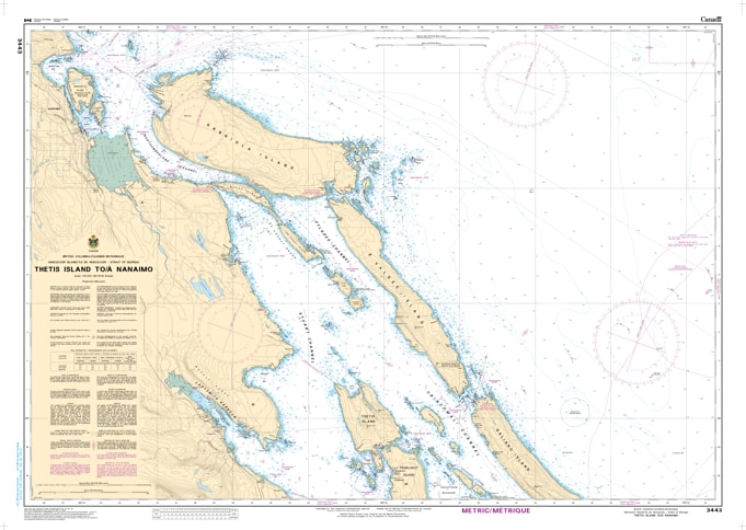
Navigate the scenic and bustling waters of the central Salish Sea with the professional authority of the Canadian Hydrographic Service (CHS). Chart 3443 is the vital "road map" for mariners transiting the coastline from the northern reaches of Thetis Island to the busy commercial and recreational hub of Nanaimo.
The route between Thetis Island and Nanaimo is famous for its narrow passes and significant commercial traffic. CHS Chart 3443 provides the "ground-truth" data required for safe passage:
High-Resolution Detail: Offers the granular data necessary for navigating the legendary tidal currents of Dodd Narrows and the technical approaches to False Narrows.
Major Commercial Corridors: Provides accurate bathymetry and shipping lane markers for Northumberland Channel, a primary route for ferries and cargo vessels heading to Nanaimo.
Island Archipelago Coverage: Includes comprehensive mapping of Valdes Island, Gabriola Island, and De Courcy Island, identifying safe anchorages and sheltered passages.
Hazard & Safety Marking: Explicitly marks submerged rocks, reefs, and navigational aids, ensuring safe pilotage through the complex island chains and into the industrial heart of the Nanaimo waterfront.
As the primary nautical reference for one of the most traveled sections of the Strait of Georgia, the reliability of Chart 3443 is paramount. Whether you are a professional pilot on a BC Ferry, a commercial fisherman, or a recreational boater cruising the Gulf Islands, this official CHS chart delivers the accuracy and detail needed to navigate from port to port with total confidence.
| Feature | Details |
| Chart Number | 3443 |
| Region | Pacific Coast (Vancouver Island East / Strait of Georgia) |
| Scale | 1:40,000 |
| Publisher | Canadian Hydrographic Service (CHS) |
| Key Coverage | Thetis Island, Nanaimo Harbour, Dodd Narrows, Valdes Island, Gabriola Island |
| Vessel Compliance | Meets official carriage requirements for safe marine navigation |