QUESTIONS? CALL OR TEXT! 1 (877) 921-6277 or (403) 266-2241
WE SHIP EVERYWHERE!

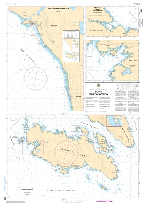
Navigate the intricate harbors and sheltered anchorages of the Salish Sea with the professional authority of the Canadian Hydrographic Service (CHS). Chart 3533 is a specialized "road map" of high-resolution inserts, providing the granular detail required for safe entry into several key ports and coastal havens within the Strait of Georgia.
While coastal charts guide you across the open water, Chart 3533 provides the "ground-truth" data required for the most technical part of your journey—the arrival. This chart features multiple large-scale plans, including:
Lund & Westview (Powell River): High-detail mapping for these essential Sunshine Coast hubs, providing safe leads into marinas and commercial docks.
Texada Island Harbours: Detailed plans for Blubber Bay and Sturt Bay, essential for mariners navigating the industrial and recreational waters of Texada.
Savary Island & Anchorages: Provides the necessary bathymetry and seafloor data for safely anchoring in the shifting sands and popular summer stops around the northern islands.
Hazard & Navigation Markers: Each plan explicitly marks submerged rocks, local buoys, lights, and beacons, ensuring maximum situational awareness in confined waters.
With the high volume of recreational cruising and commercial activity in the Strait of Georgia, the reliability of Chart 3533 is more vital than ever. Whether you are a local resident, a commercial fisherman, or a visitor exploring the Sunshine Coast, this official CHS collection of plans delivers the accuracy and detail needed to move from the open sea to the dock with total confidence.
| Feature | Details |
| Chart Number | 3533 |
| Region | Pacific Coast (Central & Northern Strait of Georgia) |
| Format | Collection of Inset Plans |
| Scale | Various Large Scales (High-Detail) |
| Publisher | Canadian Hydrographic Service (CHS) |
| Key Coverage | Lund, Westview, Blubber Bay, Sturt Bay, Savary Island |
| Compliance | Meets official carriage requirements for harbor navigation |